
1
Ammathus
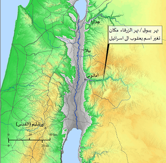
Amathus is a fortress located near the Jordan River, north of the Yabuq River and about 30 km south of Bila, in 98 BC.It was controlled by Theodorus and then taken over by Alexander Janius, but he was unable to keep it for long, and years later he demolished it.
Read More2
Ain Nun near Salim
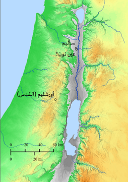
Ain Noon is located near the city of Salem in northern Palestine. The word eye in Aramaic means a spring of water, as in Arabic. Therefore, the meaning of “Ain Nun” in Aramaic is abundant (heavy) water. Ain Nun is mentioned in the Gospel of John
Read More3
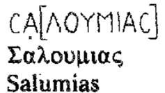
Salumias
Salem, mentioned by Bishops Eusebius, Procopius of Gaza, and Nun Etheria (chapter. 13:3-14:3) The site appears on the Madaba archaeological map under the name “Salomias”, and is also mentioned in the Bible under the name “Salem”. The site is located about 12 km south of Beisan.
Read More4
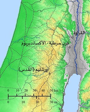
Koreus
It was mentioned by Josephus in his book (Jewish war (1:6:5, and it was a rest stop on the main road linking Jericho and Beisan, and is now known as “Al Qarawah” and is located at the lower Wadi Al Far’a,
Read More5
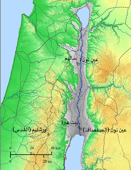
Ainon
Pratum mentioned it under the name Sabsavas willow, an Aramaic word meaning willow tree (willow). Willow (Ain Nun) is mentioned in the Bible as another place of baptism by Saint John the Baptist.
Read More6
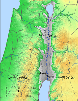
Bethabara
The name “Beit Abra” ” is of Aramaic origin and means place of transit. It is located west of the Jordan River, where Saint John the Baptist first baptized.
Read More7
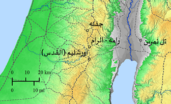
Bethnamran/ Bethnambris
Bishop Eusebius mentioned Tell Nemrin in (Philippians 44:16-18) and it was called in the Old Testament under the name (Beth– Nemra), meaning the place where the “tigers” were found.
Read More8
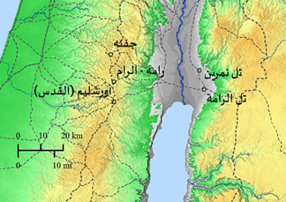
Betharam
It was mentioned in the Bible under the name Beit Haram or Beit Harran, and in the time of the Roman Emperor Augustus (Augustus) it became called Livias (Livias) or Julias (Julias), and Bishop Eusebius also mentioned it (in. 48:13–15).
Read More9
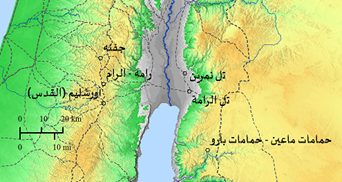
The hot spring of Baaras
It was mentioned by Bishop Eusebius in his book “The War of the Jews”, and in his book “Onomasticon” (in 44:21–46:2), and it was also mentioned by Peter the Iberian (Petros the Iberian),
Read More10
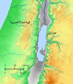
Kallirrhoe
At this site there are hot springs, “Kalirho Springs”, which means “beautiful springs”. The site was mentioned by Josephus The Jewish War 1:33:5, as well as Pliny, and many Arab and foreign Jewish and Christian travelers.
Read More11
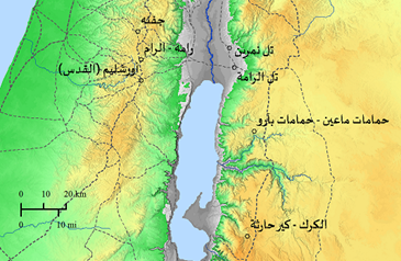
Charachmoba
arak appears as a fortified castle on top of a mountain, and to the east of it appears a church with a red brick roof. Two colonnaded roads extending from south to north also appear, Karak mentioned in many Greek and Latin historical sources, under the name “Moab Castle”.
Read More12
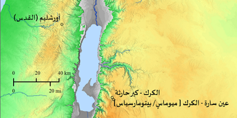
Ain Sarah– Al-Karak
It was called Miomas/Bitomarcia – Betomarsea or MayomasIt appears on the map of Madaba in the form of adjacent houses, and in the middle of it is a building with a dome, and at the bottom appears a valley or a stream of water, perhaps the stream of Ain Sarah.
Read More13
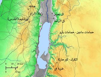
Aia
“Ai” (coord. 211 – 060) This site was not mentioned in Byzantine sources and references. It was located in the south of Karak, about six kilometers away in Wadi al-Fakht, and appears on the map of Madaba with a wall and fortified towers.
Read More14
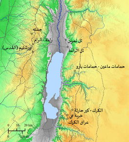
Tharais
The site is not mentioned in Byzantine sources and is located near Karak at Ain Tar’in and Sil al-Judaira, which is about five kilometers northeast of Khirbet Ay.
Read More15
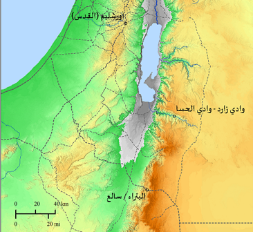
Zared
Zard is the ancient biblical name for Wadi Al-Hasa, as it was mentioned in the Bible, and Bishop Eusebius also mentioned this site in his book The Onomasticon (On. 92:10).
Read More16
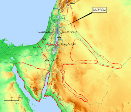
Petra
The location of Petra is at the edge of the original map, where two letters and part of a third letter appear. It does not appear on the map now because it was damaged. The phrase mentioned in the map has been translated as follows:
Read More17
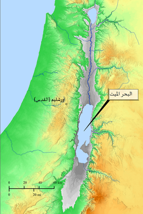
Dead Sea
The Dead Sea was mentioned by Bishop Eusebius (Eus.On 100:4-5) (3rd century AD) and is clearly much larger on the Madaba map than it is today (2024 AD). Even the tongue of the Dead Sea mentioned in the Book of Joshua (c. 5th century BC)
Read More18
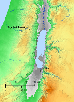
Zoar
It is mentioned in the Bible several times and also in many Greek, Latin, Hebrew and Arabic manuscripts. During the Byzantine period, Zoar was a medium-sized administrative city and the center of a Christian diocese.
Read More19
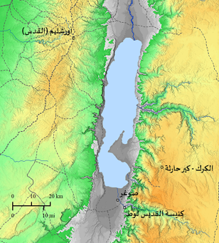
St. (the Righteous) Lot Church
The location was unknown before the Madaba map, and in 1983 it was discovered by H. Donner EA. Knauf and where the remains of a Byzantine church were found with two caves believed to have been inhabited by Lot,
Read More20
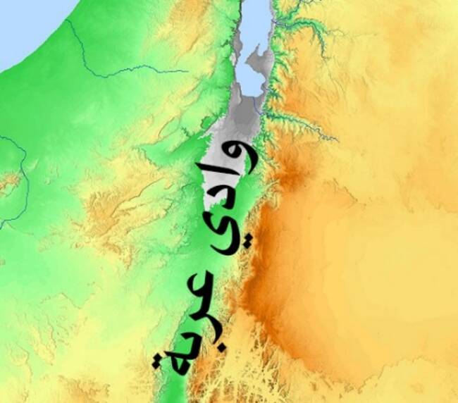
Wadi Araba Desert
It is the northern desert region of Wadi Araba, i.e. south of the Dead Sea.
Read More21
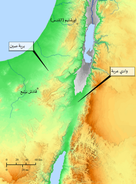
The Wilderness of Zin
This site dates back to the incident mentioned in the Bible, Numbers (21: 6-9), when God sent snakes upon the children of Israel because of their complaints,
Read More22
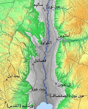
Phasaelis
This site was mentioned by Josephus in his book The War of the Jews (Jewish war 1:21:9), and also mentioned by some of the early Church Fathers. It was built by King Herod the Great of Edom,
Read More23
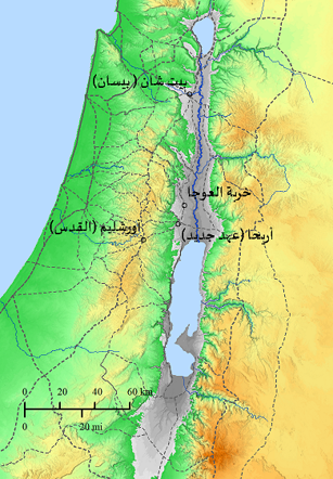
Archelais
It was mentioned by Josephus in the third century AD, and was mentioned in (Peutinger Plates), and it appeared on the mosaic map of Madaba (sixth century AD) under the name Archelais.
Read More24
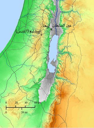
Elisha
This site was mentioned by many Jewish, Christian and Muslim travelers, including Bishops Eusebius and Procopius of Gaza. A church dedicated to the Prophet Elisha was built on this site.
Read More25
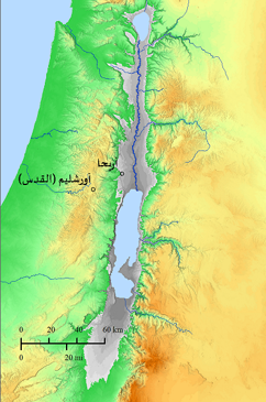
Jerico
Jericho is one of the oldest cities in the world. It is mentioned several times in the Bible, and by many Jews, Christians, and Muslims at varying times.
Read More26
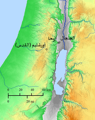
Jaljala
The first camp for the Hebrews after crossing the Jordan and entering the land of Canaan. Here, twelve stones were erected, taken from the bottom of the river as a memorial for the crossing into the land of Canaan
Read More27
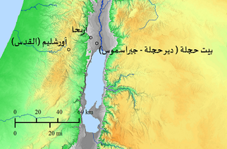
Atad
The Beit Hijleh area is located west of the Jordan River. The word Atad is Aramaic and means threshing floor. It was named after Atad (Coord. 197 – 136) near Ain Hijla, and it was also mentioned by Bishop Eusebius in his book The Onomasticon (On.8: 17 – 20)
Read More28
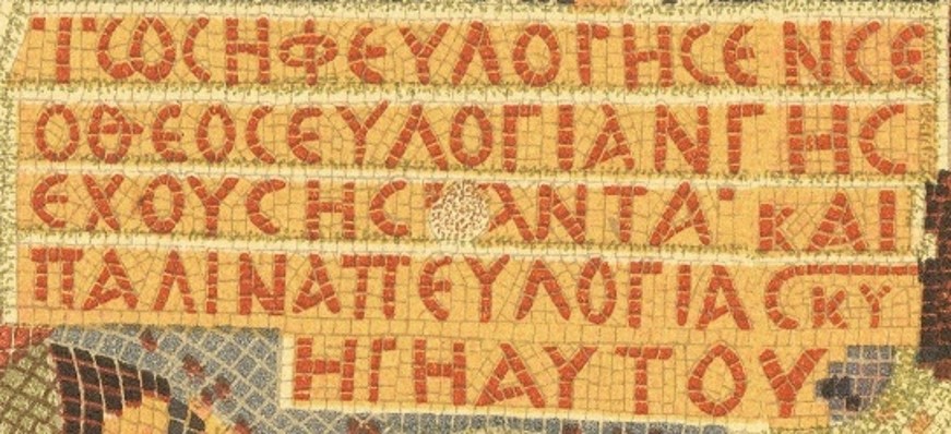
God’s blessing to Joseph
The red map of Madaba reads “Blessing from God to Joseph.” Its words were taken from Genesis and Deuteronomy, and the phrases of blessing read as follows (adapted):
Read More29
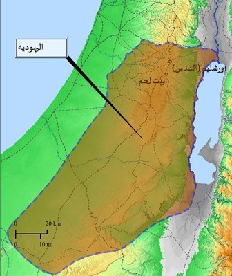
The eastern border of Judaism
The eastern border of Judaism, and this text is taken from Bishop Eusebius (Eus.O 14:7)The map above shows the entire borders of Judaism as they were known at the time of the Byzantines.
Read More30
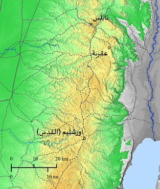
Akrabim
The site of Aqrabim is now known as the town of “Aqraba”, located in the southwest of the city of Nablus, about 16 kilometers away.
Read More31
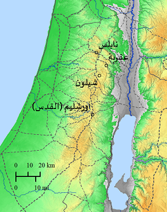
Shilo
It was mentioned in the Bible in 1 Samuel, and in the writings of some Christian travelers who visited the holy places. It is now known as Khirbet Shilon,
Read More32
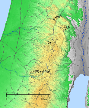
Neapolis
It is now known as the city of Nablus, which was founded in 73 AD. By Emperor Vespasianus (Vespasianus), after the Romans destroyed the Temple in Jerusalem in 70 AD, the city of Nablus appears on the map with the following details:
Read More33
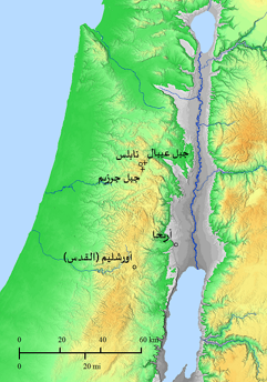
Gerizim and Ebal
Mount Ebal and Mount Gerizim appear twice on the map of Madaba near Nablus, and a second time near Jericho on its northwestern side. Bishop Eusebius established the two places near Jericho, adding the following observation:
Read More34
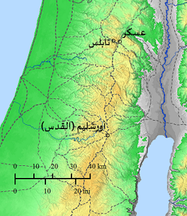
Sychar
Sukhar is mentioned in the Bible, mentioned by Bishop Eusebius (164:1-4), and also mentioned by many early Church Fathers and travelers, now known as “Askar” near Nablus (Coord. 177.180) Saint Jerome (Ironimus),
Read More35
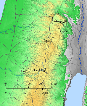
The tomb of Joseph
This site was mentioned by Bishop Eusebius (54:23 – 24), and by some Jewish, Christian, and Muslim writers. The place is now known as Joseph’s Tomb (coord 177 – 180), which is located east of the old city of Nablus.
Read More36
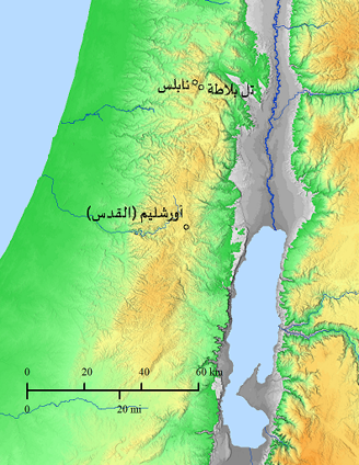
Tell Balata
She was called Salomias (Salumias) – ShechemThis text was taken from Bishop Eusebius (On. 150:1-7) The site is now known as Tell Balata, which is located near Nablus (Shechem) to the east.
Read More37
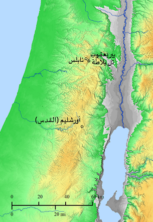
Jacob’s Well
Pir Yakub was mentioned in the Bible and in Christian writings since the fourth century AD. The site was located near Balata (coord 177-179).
Read More38
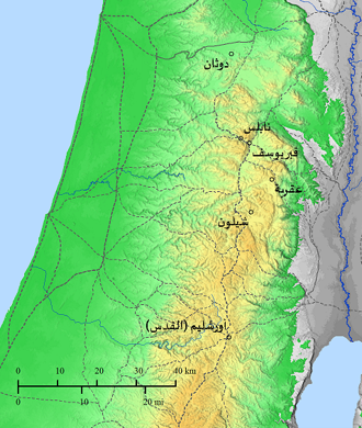
Dothan
Mentioned in the Bible as the place where Joseph found his brothers tending their sheep when their father Jacob sent him,
Read More39
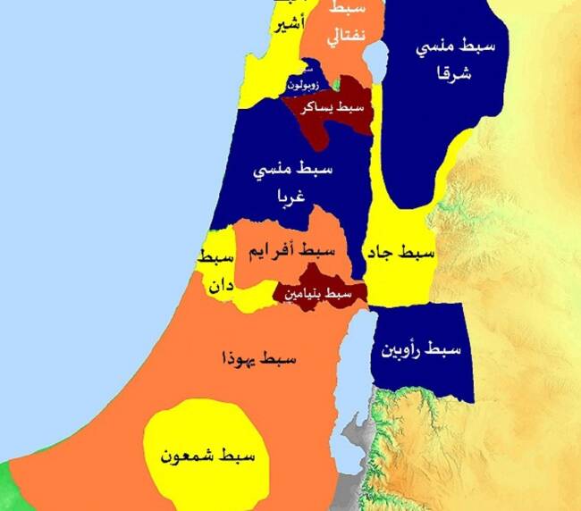
The lot of Aphraim
Joshua 16:5(5) And the children of Ephraim were judged according to their families. And their portion was bordered to the east by Ataroth, which went to the house of Huron the Most High.
Read More40

41
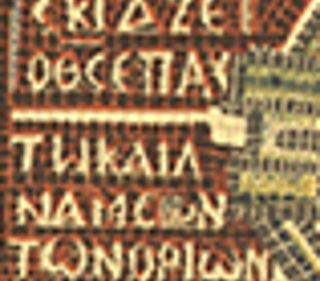
Deuteronomy 33:12
This text is taken from the Book of Deuteronomy, and the written phrase is addressed from Moses the prophet to the tribe of Benjamin when he gave him the blessing
Read More42
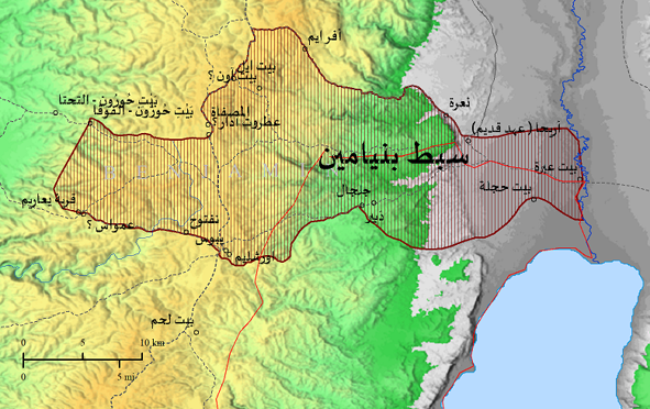
The Lot of Benjamin
The borders of the tribe of Benjamin as determined, noting that Jerusalem, which was called Jebus, is among the lands of the tribe of Benjamin.
Read More43
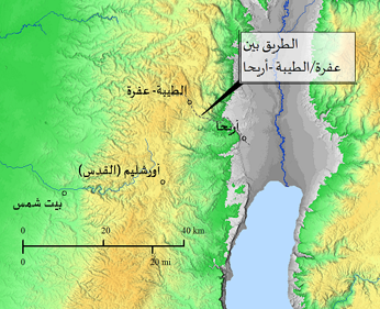
Ephron
This site is mentioned in the Bible, and was mentioned by Eusebius in Onomasticon (Eus. On. 90: 18f) and (28: 4f), and also in the book Jewish war by Josephus,
Read More44
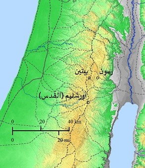
Remmon
Mentioned by Bishop Eusebius (Eus. On. 144: 11f), and its location was determined at the town of “Ramon”,
Read More45
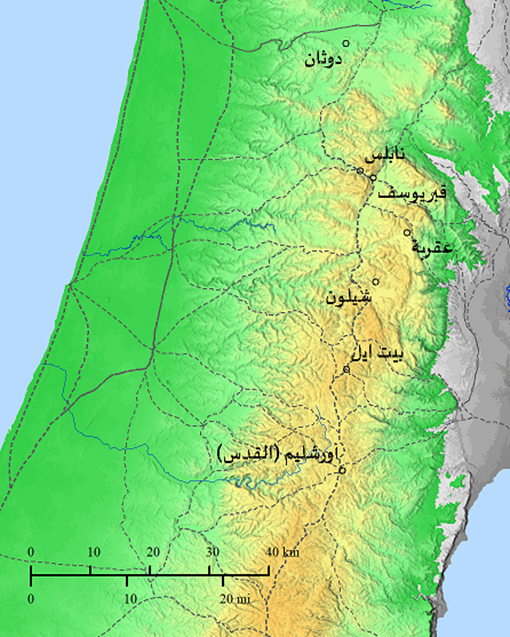
Bethel (Luz)
This site is mentioned several times in the Bible, and in the book Onomasticon by Bishop Eusebius (Eus. On. 40:20-24 and 120:8-10),
Read More46

47
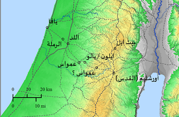
Ajalo
Bishop Eusebius also mentioned this site (Eus. On. 18:13-16), and when the name was translated from Greek as it appeared on the map of Madaba, it became (Ailamon),
Read More48
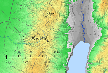
Gophna
Mentioned by Josephus in his book The War of the Jews (3:5 Part III), not mentioned in the Bible, the location is set (coord. 168: 16)
Read More49
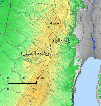
Ram
It was mentioned by Bishop Eusebius (On. 144:14 f) and mentioned in the Bible, now known as the town of Ramah
Read More50
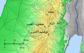
Gabaon
The Bible is mentioned in it several times, as is Bishop Eusebius (Eus On. 66:11-6). The site is now known by this name
Read More51
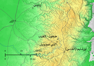
Armathem
Rantis is mentioned in the Bible in several verses, and is known as Armathem/Ramathaim Aremathia, mentioned by Bishop Eusebius (Eus. On. 32:21-23) and in (144:27-29)
Read More52
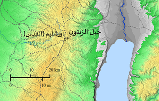
Gethsemane
This site has been mentioned several times in the Bible, and also by many Christian pilgrims. It is still known as Gethsemane (Olive Press)
Read More53
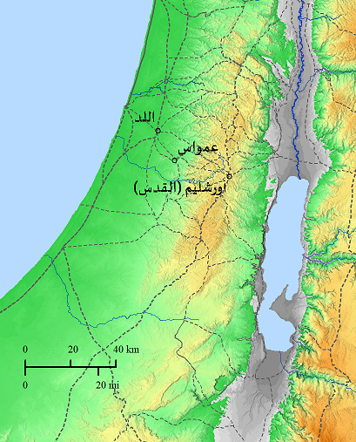
Fourth mile stone
Roman road sign for the 4th mile, a rest stop on the road linking Jerusalem (Jerusalem), Emmaus and Lod.
Read More54
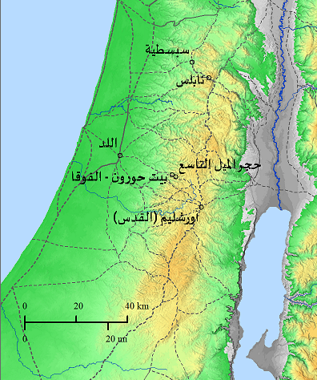
The ninth mile stone/Khirbet al-Tarm – Khirbet al-Latatin
Roman road sign for the 9th mile, a stop on the Roman road near Bethoron, believed to be Khirbet al-Latatin.
Read More55
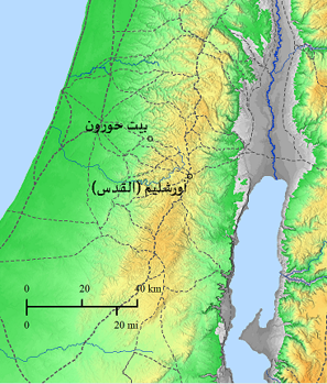
Bet Huron – Bet Awar
The House of Huron was mentioned in the Bible several times (about twenty times), and is now known as the House of Or, and there is the House of Or al-Tahti and the House of Or al-Fawqa, and as mentioned by Eusebius and many travelers.
Read More56

57
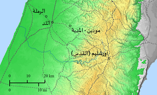
Moditha
The name of the site is “Modim / Modin” and it is now known as Moditha, which was a place belonging to the Maccabees. The place was located in the Ras area near Media (Cord 150 – 149), which is about 12 km east of the city of Ramla.
Read More58
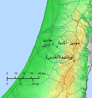
Adiathim
It was mentioned in the First Book of Maccabees and was also mentioned by Bishop Eusebius in his book (Antiques 8:6:4 page 203) and in (Esu. On.24: 24 f) where the location was located in the village of B “Hadid” (coord 145 – 152) which is located five km east of the city of Lod.
Read More59
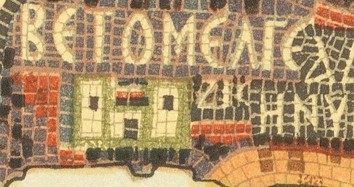
Betomelgezis
The chosen name for the site has yet to be determined, and there is no reference to it in any historical manuscript.
Read More60
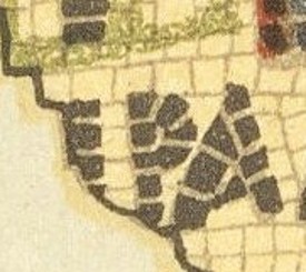
undetermined location
Three letters remain from the name of the site, and this place has not been identified or known yet.
Read More61
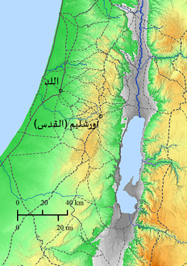
Diospolis
It was named (Diospolis) during the time of the Roman Emperor Septimius Severus (Septimius Severus) (193 – 211) AD, now known as Lydda (Cord 140 – 151). The city was mentioned in several historical sources, and appeared on the map of Madaba without a wall around the city.
Read More62
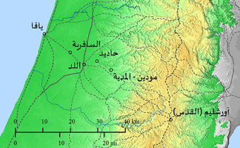
Sapharea
Safriyya did not appear in Byzantine writings and sources, but it did appear in writings during the Crusader period
Read More63
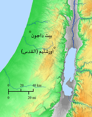
Betodejana
The House of Dagon / House of Dagon is mentioned several times in the Bible, and was mentioned by Bishop Eusebius (50:15f) Eus On.
Read More64
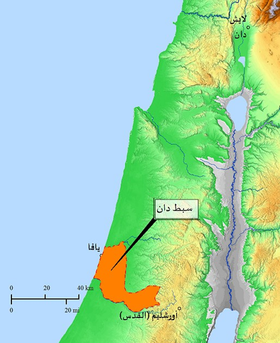
The lot of Dan
The name Dan in Hebrew means “judge”, meaning the one who condemns. They had no peace or comfort in their place of residence, and they had the smallest area among the other tribes.
Read More65
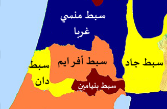
Why did Dan settle at the ships
This phrase Why did Dan settle near the ships – that is, he settled and submitted appears in the mosaic of the map of Madaba. It is taken from the song of Deborah in the Book of Judges (Judges 5:17).
Read More66
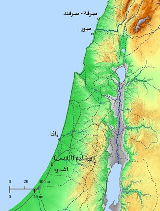
The Sanctuary of St. Jonah
A site that appears on the map of Madaba as a shrine to “Saint Jonah” with a red dome and two towers. There are several shrines dedicated to Saint Jonah,
Read More67
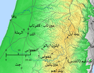
Unspecified, may be Ain Tab in “Kafr Tab”
This site is not definitively located, but it is mentioned in Hebrew heritage books. The name means “good spring of water.”
Read More68
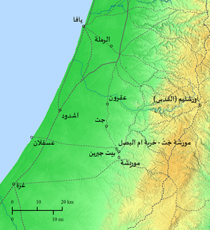
Geth
Jatt is one of the cities of the five Palestinian kingdoms that existed in southwestern Palestine, namely Jatt, Ekron, Ashdod, Ashkelon, and Gaza.
Read More69
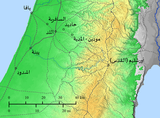
Jabneel
It was mentioned in the Bible in the Book of Joshua under the name Yabniel, after the destruction of the Temple in Jerusalem (Jerusalem (Jerusalem)) in 70 AD by the Romans. After that,
Read More70
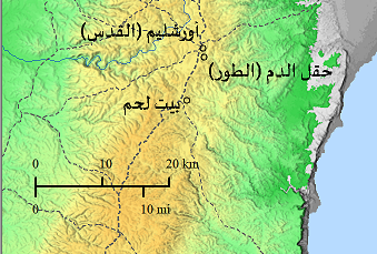
Akeldama
It is the place of the field that was purchased with thirty pieces of silver that Judas Iscariot took as a price for handing Jesus Christ over to the Jews, according to what was stated in the Acts of the Apostles and in the Gospel of Matthew.
Read More71
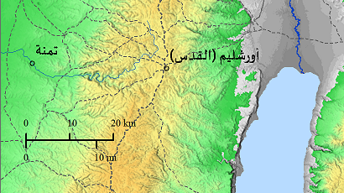
Thamna
The name Tamna is mentioned in the Bible, and it is the place where Judas sheared his sheep. On the map, it appears very close to Jerusalem, not as it appears in its current geographical location.
Read More72
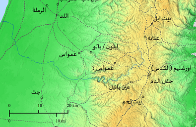
Anob
It was mentioned by Bishop Eusebius in his book Onomasticon (Eus.On. 20: 15-17), and there is difficulty in determining the location, and it may be the town of Annaba in Palestine, about 4 km away from the city of Ramla, or the town of Annaba between Jerusalem (Jerusalem) and Beit El
Read More73
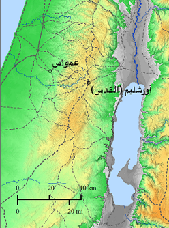
Nicopolis
Emmaus mentioned ( (coord. 149-138 in Luke 24:13, and also by Bishop Eusebius (Eus. On.90:15-17), it appears in most Christian and traveler writings of the region, and in many writings of the early Church Fathers.
Read More74
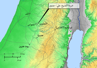
Gedur
There is a problem in locating “walls”/”walls” mentioned by Bishop Eusebius (Eus. On. 68:22f), about ten miles on the road between Lydda and Beit Jibrin, is a large village, perhaps Khirbet Sheikh Ali Jader (Cord 146-137),
Read More75
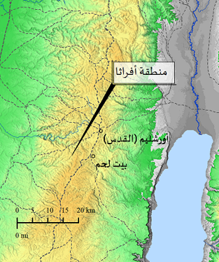
Ephratha
Afratha means the fruitful region in Aramaic, which is the Bethlehem region. It is marked in red on the map of Madaba, and it contains the tomb of Rachel, the wife of Jacob. It is mentioned in the Bible and in the writings of many travelers.
Read More76
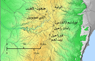
Rama
It is mentioned in the Bible several times, and it is supposed to be near Bethlehem on the road between Jerusalem and Bethlehem. Recently, in 1921 AD, a colony was built called Ramat Rachel,
Read More77
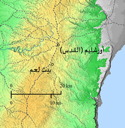
Bethlehem
The meaning of the word Bethlehem is the House of Bread. It is a small town located in the south of Jerusalem (Jerusalem), where King David and Jesus Christ were born. Sometimes it was called Bethlehem of Judea, Bethlehem of Ephrata,
Read More78

79
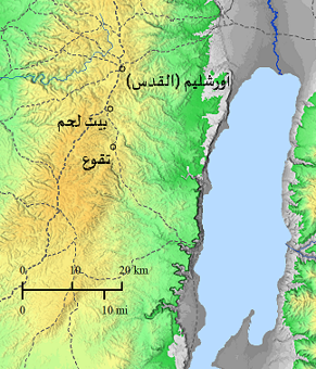
Thekoa
It is mentioned in the Bible several times, and by Bishop Eusebius (Eus. On. 86:12: -14), which is the place of birth of the Prophet Amos, appears as a location on the map of Madaba and contains a church that may have been built over the tomb of the Prophet Amos.
Read More80
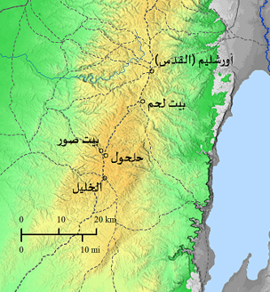
Bethsura
Mentioned by Bishop Eusebius (Eus. On. 52:1-5) and many Christian authors for its close relationship with the Spring of Saint Philip, where the eunuch of the Queen of Abyssinia’s minister was baptized,
Read More81
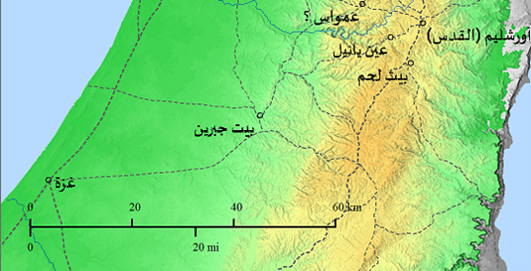
St. Philipp
It is believed that Saint Philip baptized a eunuch minister to the Queen of Abyssinia, Canada, at Ain Yael on the Roman road between Jerusalem (Jerusalem) and Gaza. There is another site that believes that the baptism of the Minister of the Queen of Abyssinia took place in the Beit Sur area near Halhul.
Read More82
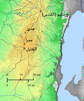
Mambre
“Mamra” is mentioned in the Bible several times and is located at the entrance to Hebron (Hebron), and was mentioned by Josephus in his book The War of the Jews at Automastikon (On. 6:8-16),
Read More83
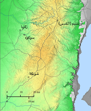
Socho
It was located by Bishop Eusebius (On. 156: 18-20) and John Moschus (John Moschus) and the site was set at Khirbet Abbad (Cord. 148 – 120) It is located 3 km southeast of the village of Zakaria.
Read More84
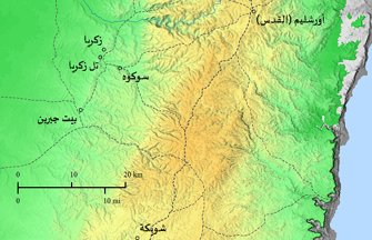
Zacharias
The Bible does not mention any place or location called the House of Zechariah, but the names of known people are mentioned in it. As for the location of the House of Zechariah,
Read More85
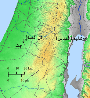
Saphitha
This site is a Byzantine village, which may be Khirbet al-Safi, about 1 km from the site of Tell al-Safi. It is within the biblical region of Gath and was not mentioned in ancient sources.
Read More86
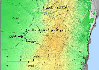
Morasthi
Murshahjet, the name meaning “near Jet,” was the birthplace of Micah the prophet (Micah 1:14). Saint Jerome (Ironimus) (4th century AD) says that it was a short distance from the city of Beth-geren, which suggests that it was “Khirbet Umm al-Basal” or Tell al-Hudaydah,
Read More87
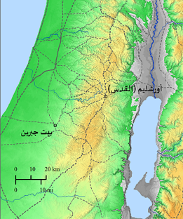
Elutheropolis
Beit Jibrin (coord, 140-112), the writing on the map of Madaba is destroyed except for one letter, there is a wall surrounding the city and it has three towers,
Read More88
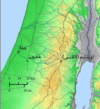
Akkaron
Ekron is mentioned several times in the Bible as mentioned by Bishop Eusebius in his book Onomasticon. 22:6-10)).
Read More89
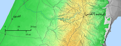
Ashdod
Ashdod is one of the cities of the ancient Palestinian kingdoms located on the Mediterranean coast and is a port, mentioned in the Bible.It appears on the map of Madaba as having a wall and towers, and there is a church whose roof is covered with red tiles.
Read More90
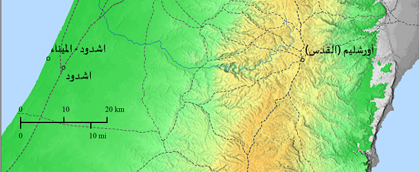
Ashdod by the Sea
It is the site of the historical port of Ashdod, and was also known as Mina al-Qalaa during the Crusader rule. The map of Madaba shows that there is a main street in the city extending from north to south, and a church also appears in the city center.
Read More91
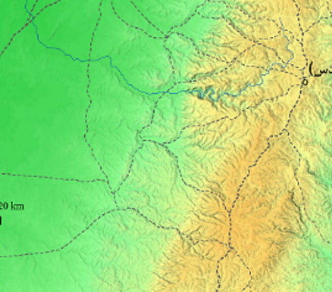
Ashkelon
Ashkelon is mentioned several times in the Bible, and in the writings of Bishop Eusebius (On. 22: 15-18), as mentioned in Jewish, Christian and Islamic writings, it is one of the cities of the ancient Palestinian kingdoms, cord 106 – 118)),
Read More92
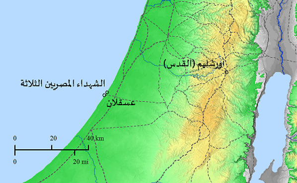
Shrine of the Egyptian Martyrs
Bishop Eusebius mentioned the location of the three Egyptian martyrs in his book “Martyrs of Palestine.” The traveler (The Piacenza) also mentioned them, where he mentioned three names of Egyptian martyrs and that their shrine was found in the ruins of Byzantine churches at a site known as Parnia (Barnea),
Read More93
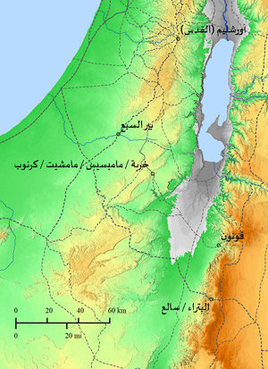
Mampsis
Mampsis (also known as Mamshit / Karnob) was mentioned by Bishop Eusebius (On.8:8), but not in the Bible.
Read More94
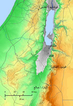
Prasidin
A Roman-Byzantine garrison, mentioned in ancient Byzantine administrative records, now known as the FIFA Palace (Cord 192 – 038) is about 4 km south of the Safi site in Ghor Safi.
Read More95
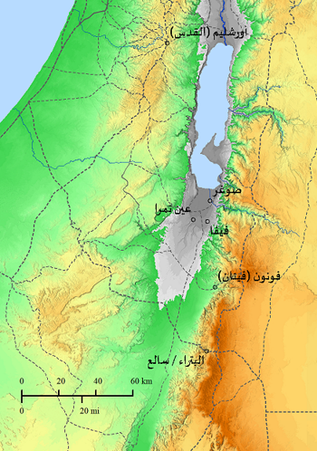
Thamara
Mentioned by Bishop Eusebius (On. 8:7-9) The site is a Roman-Byzantine Road station located south of the Dead Sea near the spring of water,
Read More96
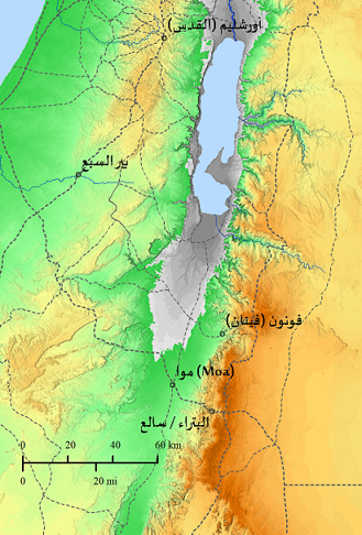
Moa
The site is a Roman-Byzantine garrison, known as “Moa Awad”, and is about 32 km southwest of Fenan.
Read More97
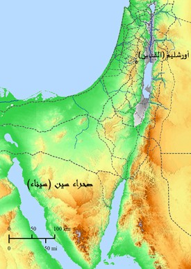
The Wildness of Sin
This writing that appeared on the map says, “The wilderness (desert) of Sin, that is, the Sinai Desert, where manna and quails were sent down”, and it is taken from the texts of the Bible
Read More98
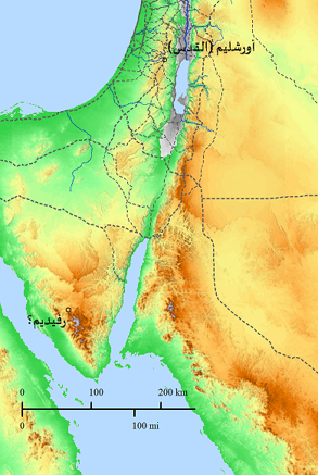
Raphidim
This writing is taken from the Bible and tells the story of the war between the Amalekites and the children of Jacob (Israel) upon their exodus from Egypt.
Read More99
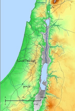
From Dan to Beershepa
The phrase “from Dan to Beersheba” appears in the Bible several times, and it symbolizes the entire land of Canaan,
Read More100
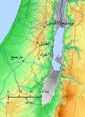
Arad
Arad was mentioned by Bishop Eusebius (Eus. On. 14:1-3) and is mentioned in the Bible several times.
Read More101
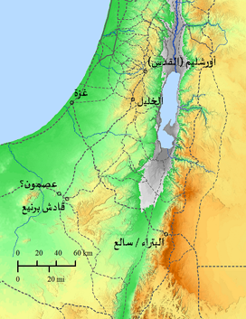
Azmon
The name is Hebrew / Aramaic and means “strong.” It is a city located in the desert in southern Palestine,
Read More102
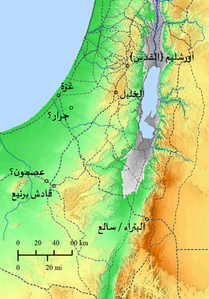
Gerar / Gerara
Jarrar is one of the cities of the Palestinian kingdoms located in southern Palestine (the land of Canaan).
Read More103
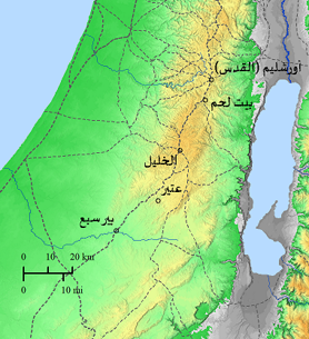
Jethor
Jattir (Jattir), mentioned in the Bible several times and mentioned by Bishop Eusebius (Eus, On. 88:3ff and 108:1-4), but there is a problem in determining the location of this place, as Bishop Eusebius appointed it in Judea,
Read More104
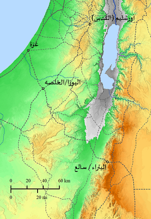
Elusa
It was not mentioned in the book Onomasticon by Bishop Eusebius, but it was mentioned in many books by Arab and foreign travelers.
Read More105

106
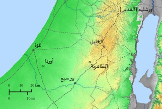
Orda
The location of Orda has not been definitively determined, and it is believed that it was an important site in the Byzantine period, and it had an active episcopal center affiliated with the “Jarrar” region,
Read More107

108
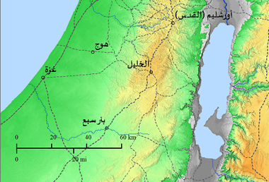
Oga
During the Roman and Byzantine era, it was called Oga. It was destroyed by the Bedouins during the Ottoman rule and rebuilt around 1880 AD
Read More109

110
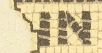
The site’s name remains unclear due to damage from mosaic patterns
The name of the site could not be known as a result of the destruction of the mosaic.
Read More111
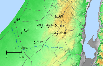
Sobila
The location of Sobilla is only mentioned on the Madaba mosaic map, and the location matches that of Khirbet al-Zabala (coord. 125 – 091), and it is about 22 km west of Zahir al-Khalil.
Read More112
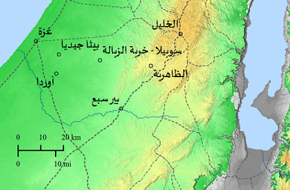
Bethagidea
The site is mentioned only on the Madaba mosaic map and is located at Khirbet al-Jundi (coord. 113-092), about 4 km north of Tel Abu Hurairah, and about 12 km southeast of Gaza
Read More113
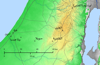
Edrain
Mentioned only on the Madaba mosaic map, it is located south of Gaza, about 7 km away.
Read More114
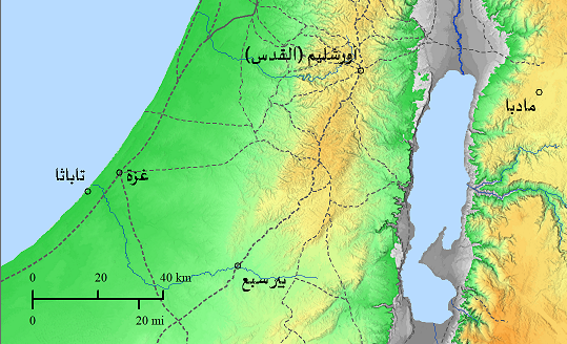
Thauatha / Tabatha
Thauatha or Tabatha “Thabatha”, is located at Khirbet Umm al-Tut, which is located south of Wadi Gaza and about 2.5 km away. It is the birthplace of Saint Hilarion (271 – 291) AD.
Read More115
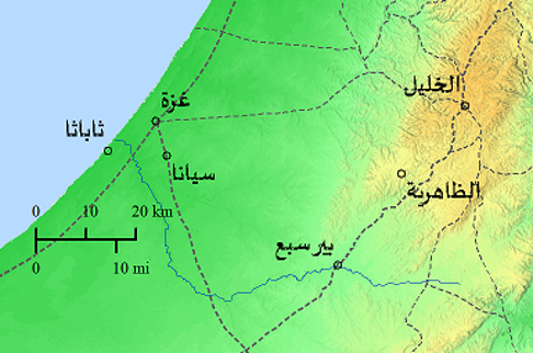
Seana
This site was mentioned only on the Madaba mosaic map, and its location was fixed near the site of Khirbet Sihan (coord. 105-95), about 6 km southeast of Gaza.
Read More116
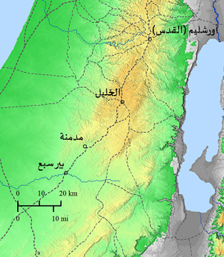
Madebena
It is mentioned in the Bible in the book Joshua 15:31(31) and Ziqlag and Madmanah and Sansanah, an Aramaic name for Dimna meaning garbage dump, now known as (Khirbet Umm al-Damna).
Read More117
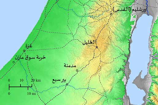
Sykomazon
The name Sykomazon appeared in Byzantine organizational documents and also in the Jerusalem Targum. The site is now known as “Khirbet Souq Mazen,” located about 11 km southwest of Gaza. A church inside the town appears on a map of Madaba.
Read More118
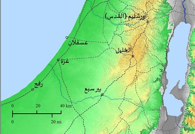
Gaza
Gaza City was founded in the 15th century BC and is one of the major and ancient Palestinian cities. It was one of the cities of the five Palestinian kingdoms. Canaanite ruins and pagan temples were found there. It was an important commercial center throughout the ages.
Read More119
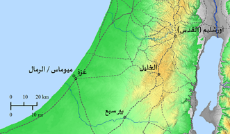
Maiumas
Myomas (Sand Area) is the port area of Gaza, about 4 km from Old Gaza. The Bishop of Gaza lived there to be far from Old Gaza, most of whose residents were pagans at the beginning of Christianity.
Read More120
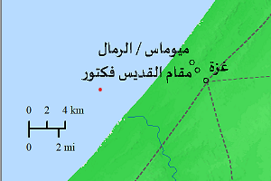
St. Victor
The shrine of Saint Victor is located between Old Gaza and the Gaza Port (Sand) area. Traveler Piasza described the tomb of Saint Victor, while Madaba’s mosaic map shows a small, beautiful church with a red brick roof.
Read More121

122
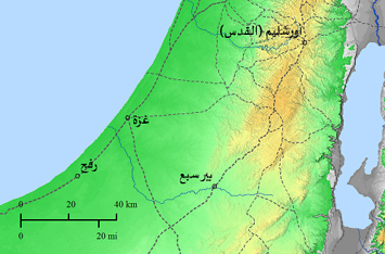
Raphia
Rafah was a border point between ancient Egypt and Palestine overlooking the sea. Only the first letter of its name appears on the map of Madaba (. (P
Read More123
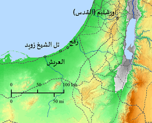
Betylion
Its location may be between Rafah and Al-Arish, and it is now known as Tel Sheikh Zuweid. The map of Madaba shows a pagan temple built on a hill that was converted by the monk Hilarion into a church at the beginning of the fourth century AD.
Read More124
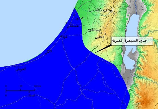
The border between Egypt and Palestine
Bishop Eusebius stated (On. 50: 18-20) The borders of Egyptian control over Palestine are located near the village of “Beit Tafuh” Thaffu (Bethaphou). Please note that these borders changed from time to time according to the balance of power at that time.
Read More125
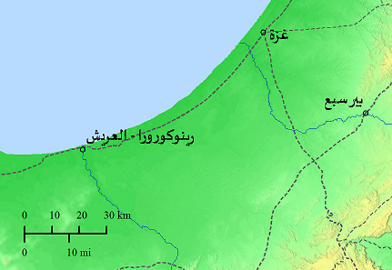
Rhinokorura
Rhinokorura (Rhinokorura) is located near Al-Arish, at the beginning of the Al-Arish Valley, known in the Byzantine period and beyond, and mentioned by Josephus in his book The War of the Jews (Jewish War I:14: 2 page 277);
Read More126
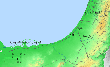
Ostrakine
The location of Ostrakin corresponds to Khirbet al-Fulusiya, which was a episcopal center in the fourth century AD. According to inherited tradition, the place is linked to the Prophet Habakkuk and the Messenger Simon.
Read More127
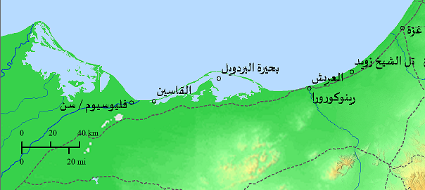
Kasin
This site is located near the shrine of Zeus Kasios, mentioned several times in Byzantine sources,
Read More128

129

130

131

132

133

134
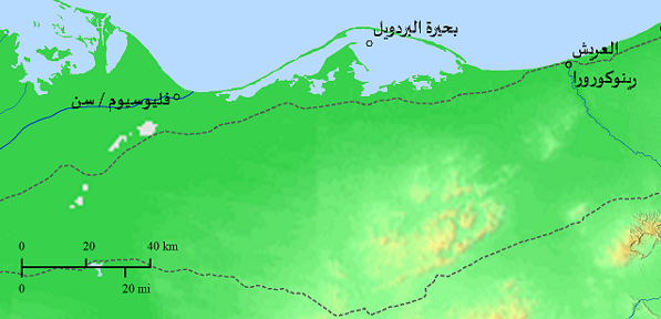
Pelusin
The city of Veliosium is located on the eastern side of the Nile branch of Veliosium. It was mentioned several times in Greek and Arabic sources. It was famous for its textile industry, and was a episcopal center since the fourth century AD.
Read More135
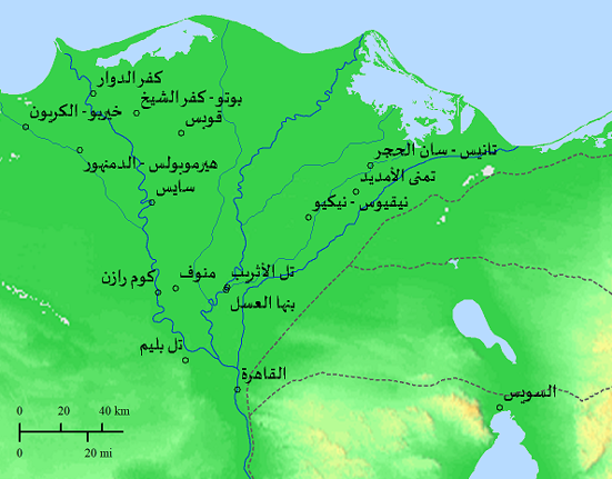
Henikiu
The city of Nicius was known as Necho and to the Greeks as Nicius or Nicio. Bishop John of Necho was from it, and some martyrs were identified from Coptic Church sources, such as Seraphim, Isaac Dafri, Makarios of Antioch, Theodoros, Stratilates and others.
Read More136
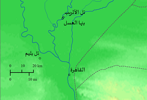
Athribis
The historical city of Athrebs is now known as Tell Athrebs, near Banha al-Asal. It appears on the map of Madaba surrounded by a wall and has two towers. Inside the wall is a basilica. The city has two gates, one of which is high, which means that the city is built on a small plateau. This city was mentioned in Byzantine, Coptic, and Arabic manuscripts.
Read More137
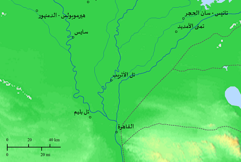
Sethroites
The city of Heracleopolis later became a province called Stroits, now called Tell Plim, and has been a bishopric since the 4th century, with monasteries and churches nearby.
Read More138
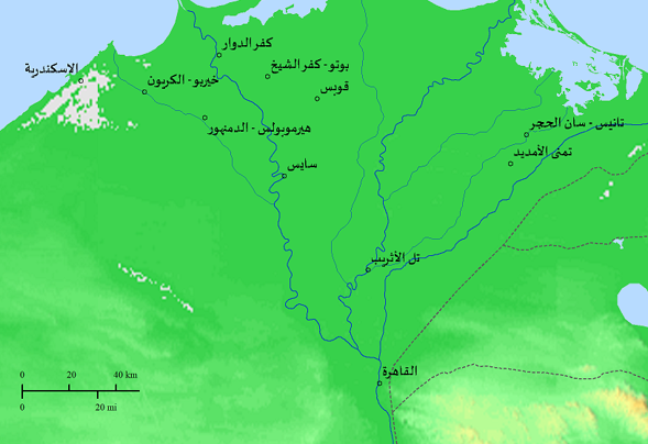
Tanis
Tanis or San al-Hajar is the Greek name for an important archaeological site in the northeastern Nile Delta in Egypt. The site of the city bears the same name and is located on the Tanitic branch of the Nile.
Read More139
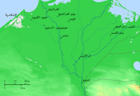
Timayy Al Imdid – Thmuis
Tamna Al-Amdid (Tamwees) (Thmuis) is located southwest of Tanis – San Al-Hajar, mentioned in several Byzantine and other references in advanced times and was an episcopal center since the third century AD,
Read More140
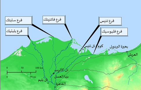
Thennesos
The site of Thynensos / Kom or Tell Tennis, which is a city on the coast in the sea / Lake Manzala. It was a commercial port and was located on a small island. It was mentioned in many Arabic and Greek sources, and it may also have been mentioned in the Bible under the name of the land of Zoan.
Read More141
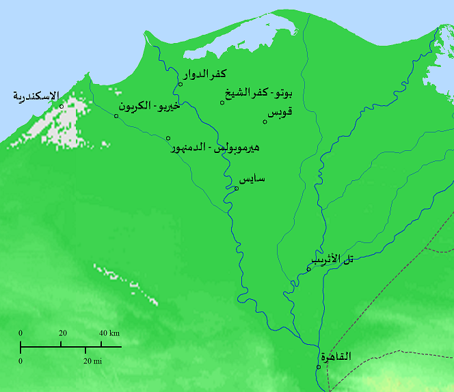
Sais
Sais is located near Kafr El-Zayat, and has been a episcopal center since the fourth century AD. On the map of Madaba, only the name and the branch of the Nile River appear, as other parts were damaged.
Read More142
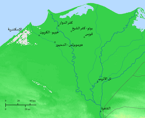
Xois
Qobas has been an Episcopal center since the fourth century and is part of the Kafr El-Sheikh region
Read More143

144
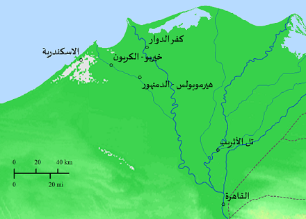
Hermupolis
The site corresponds to the site of Damanhour, which was mentioned in many Byzantine and Arabic manuscripts, and it was an important administrative center for the Alexandria region, and an episcopal center since the fourth century AD.
Read More145
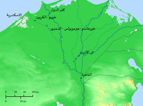
Chortaso
Khortaso is located north of Damanhour, and it is believed that Saint Habakkuk was buried there. A mosaic was recently found in Palestine in Kiryat Ghaith, in the courtyard of an ancient church in which Khortaso’s name is mentioned (Chortaso).
Read More146

147
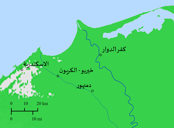
Hechaireu
Khirbu is a site mentioned in many Byzantine and Arabic manuscripts and corresponds to an archaeological site near Al-Kryon and near Kafr El-Dawwar – Giza. No Christian monuments or churches were found there until the Middle Ages.
Read More148
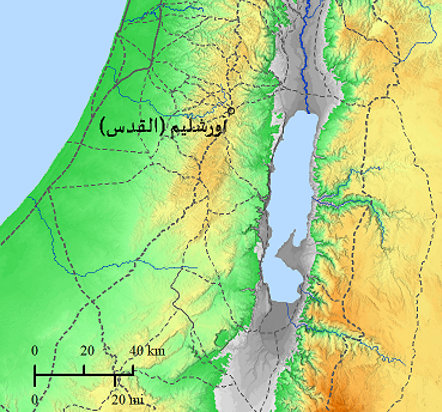
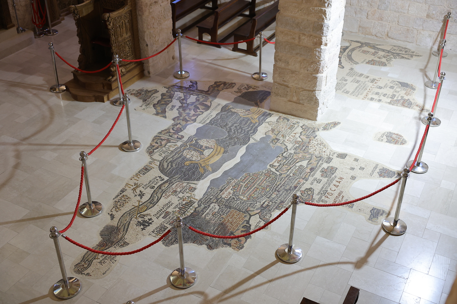
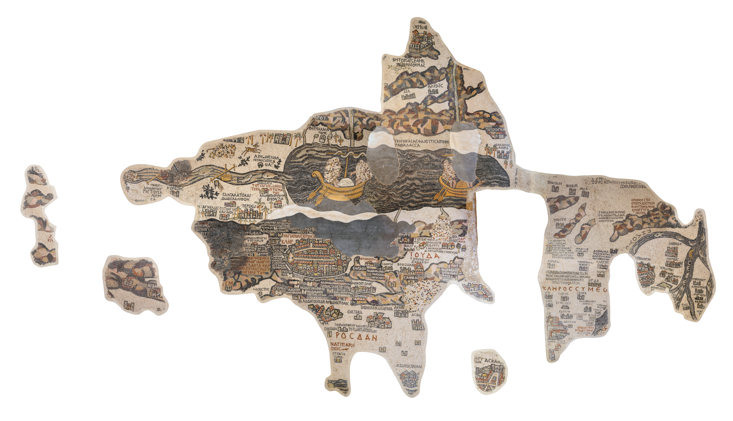
Jerusalem
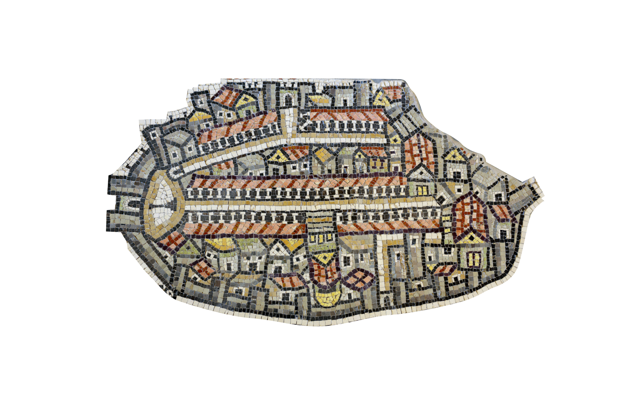
The city of Jerusalem (Jerusalem) is considered the center of the Madaba mosaic map, and it contains precise details about it that you will not find anything like it in any other city.
Read More149
The city of Sarepta
It is an ancient Phoenician site located between Tyre and Sidon. In the Bible, it is associated with the story of the Prophet Elijah and the widow who fed him despite the famine—the setting for the miracles of the unending supply of flour and oil and the resurrection of her son. It is mentioned in both the Old Testament (1 Kings 17) and the New Testament (Luke 4).(1 Kings 17:9) "Arise, go to Zarephath, which belongs to Sidon, and dwell there. See, I have commanded a widow there to provide for you."(Luke 4:26) "But to none of them was Elijah sent except to a widow, at Zarephath in the region of Sidon."Today, it is known as Sarafand, Lebanon, making it a site of significant religious and historical value.
150
zebulon
(Numbers 2:7) (7) and the tribe of Zebulun, and the leader of the children of Zebulun, Eliab the son of Helon,
151
Acchabaron
• "Acchabaron" does not appear in the Bible in this specific form, nor is there an identical name; it is most likely a corruption or a Greek rendering of a biblical site such as Acco, particularly given that its location on the map—in the northwest—aligns with this.• Its significance lies in how the Madaba Map integrates well-known biblical sites with local Byzantine locations.It is located in northwestern Palestine (on the Mediterranean coast).
1
St. Anne’s Church / Pool of Bethesda
The church is located at the twin pools known as Bethesda (Bethzatha), where Jesus healed a paralyzed man who had been lying by the pool for many years (John 5:1–9). Early Christian traditions, based on the apocryphal Gospel of James, place the house of Saints Joachim and Anne, the parents of the Virgin Mary, at this site, making it a shrine for the birth of Mary herself. Excavations have confirmed the existence of a Byzantine basilica here, over whose foundations the Crusaders later rebuilt the current Church of St. Anne.
2
Sheep Gate / St. Stephen’s Gate
Today: Lions' Gate.Located in the northeastern wall, near the Pools of Bethesda. It was called the "Sheep Gate" because it was the entrance through which sheep intended for sacrifice were driven into the city, as mentioned in the Book of Nehemiah (3:1) among the rebuilt gates of Jerusalem after the exile. The name "St. Stephen’s Gate" is linked to an old Christian tradition stating that Stephen the Deacon, the first martyr of the Church, was led out through this gate to be stoned outside the walls (Acts 7).
3
The Main Street
The great colonnaded street paved by the Romans when they established "Aelia Capitolina" following the destruction of Jerusalem in 135 AD, later expanded by Justinian I and extended southward in the 6th century to reach the New Nea Church. The mosaic depicts it as two rows of columns topped by red roofs, a scene confirmed by excavations in the Jewish Quarter of the Old City of Jerusalem, where a section of the Cardo was uncovered and restored as a tourist street.
4
Church of Damianus
Located along the main street near the center of the city in the map's depiction. Scholars have not reached a definitive identification of this specific church; 6th-century pilgrims, such as the pilgrim Theodosius, describe a number of small structures lined along both sides of the Cardo whose precise names were not preserved in sources to this day, and this site is one of them.
5
Damascus Gate
The main gate in the northern wall, from which the road toward Damascus began. Its name derives from a massive Roman column that stood in the circular plaza behind the gate, as archaeological excavations beneath the current Ottoman gate have revealed, confirming the mosaic's accuracy. This column was likely the measuring point for distances from the city during the Roman era, preserving its Arabic name "Bab al-Amud" (Gate of the Column) to this day despite the column's disappearance centuries ago.
6
Damascus Gate Plaza
The semi-circular plaza located inside the entrance of Damascus Gate, which was centered around the famous Roman column. This plaza was a crossroads and a major gathering point in the Roman and Byzantine city, and archaeologists discovered its original foundations beneath the current gate, matching the mosaic drawing remarkably.
7
Eastern Plaza of the Church of the Holy Sepulchre
The front courtyard that preceded the facade of the Constantinian church, depicted in the mosaic with its four steps, three doors, and triangular facade, according to early pilgrim descriptions such as the Bordeaux Pilgrim (333 AD) and the historian Eusebius of Caesarea. This courtyard separated the main street from the sacred church courtyard, preparing the visitor to enter the holiest place in the Christian world.
8
Church of the Holy Sepulchre – Golgotha
The great basilica ("Martyrium") built by Constantine the Great between 325 and 335 AD, after his mother Queen Helena identified this site as the ground of the Crucifixion, following the removal of a pagan temple that Emperor Hadrian had deliberately erected over it in the 2nd century. Golgotha has since become a central shrine for pilgrims from across the Christian world.
9
The Holy Sepulchre
The round structure with the golden dome, known in Byzantine sources as the "Anastasis" (Resurrection), houses the rock-cut tomb believed to be the tomb of Jesus Christ and the location of His resurrection. Its golden dome stands out clearly in the mosaic, being one of the most recognizable details of the map, confirming the central status of this location in Byzantine Jerusalem from the 4th century to the present day.
10
The Beautiful Gate – Golden Gate
The eastern gate of the Temple Mount, overlooking the Mount of Olives and the Kidron Valley. An ancient Christian tradition connects it to the "Beautiful Gate" mentioned in the Book of Acts (3:2), where Peter the Apostle healed a lame man. Tradition also attributes Jesus' entry into Jerusalem riding a donkey on Palm Sunday to this gate, fulfilling the prophecy of Zechariah (9:9). This gate was later sealed in the Islamic period, and popular tradition links its closing to the expectation of the Savior Christ returning through it at the end of time.
11
Temple Mount
The site of Solomon’s Temple and later the Second Temple expanded by Herod the Great, the holiest site in Judaism. The Romans destroyed the Temple in 70 AD following the First Jewish Revolt, and the site remained in ruins throughout the Byzantine era; Christians saw this as the fulfillment of Christ's prophecy: "Not one stone will be left on another" (Matthew 24:2). Therefore, the map depicts it as an almost empty space, as the Dome of the Rock and the Al-Aqsa Mosque were built only after the Islamic conquest, decades after the mosaic was created.
12
Church of the Virgin Mary, Mother of God
The massive new church ("Nea") built by Emperor Justinian I and dedicated in 542 AD in the name of the Virgin Mary, Mother of God, as described by the historian Procopius in his book "De Aedificiis". It was one of the largest churches in the Byzantine world, and excavations in the Jewish Quarter during the 1970s revealed the remains of its huge vaulted cisterns, confirming the accuracy of the mosaic's depiction and providing one of the most important pieces of evidence for dating the map itself between 542 and 570 AD.
13
Siloam Church
This church was built by order of Empress Eudocia in the 5th century over the Pool of Siloam, which was fed by the waters of the Gihon Spring via Hezekiah's Tunnel (2 Kings 20:20; Isaiah 8:6). To this pool, Jesus sent the man born blind to wash and receive sight (John 9:1–11), making both the pool and the church a shrine commemorating this miracle.
14
Zion Gate
The name "Zion Gate" is repeated in the map key at two different locations near the southeastern corner of the wall, reflecting the probable existence of more than one outlet in that direction leading to the sacred Church of Zion ("Mother of Churches") in the Byzantine period, arranged differently from the current Zion Gate built by the Ottomans in 1540 AD on a slightly altered path of the Old City wall.
15
Cardo / Maximus
The extension of the great colonnaded street paved by the Romans and later expanded by Justinian I, extending southward in the 6th century to reach the New Nea Church. The mosaic depicts it as two rows of columns topped by red roofs, serving as the commercial and religious backbone of Byzantine Jerusalem, large portions of which were uncovered by archaeological excavations.
16
The Cenacle
Located on Mount Zion, tradition holds it to be the "large upper room, furnished" (Luke 22:12) where Jesus ate the Last Supper with His disciples, and where the Holy Spirit descended upon the Apostles on the day of Pentecost (Acts 2).
17
Church of the Apostles / Mount Zion
The major basilica located on Mount Zion above the site of the Cenacle, which the Byzantines titled the "Mother of all Churches", believing it was erected on the house of Mary, mother of John Mark, where the early apostolic community gathered (Acts 1:13, 12:12). In Eastern tradition, the same site is also commemorated as the place of the Dormition of the Virgin Mary.
18
Place of Baptism
A baptismal site attached to one of the adjacent major churches; it was customary in Byzantine-era basilicas to attach a special baptistery (baptisterium) for baptizing new catechumens. Note that this location differs from the traditional baptism site of Jesus in the Jordan River, which the Madaba Map depicts in a separate section outside Jerusalem.
19
Jaffa Gate
The western gate, from which the road leads toward the port of Jaffa on the coast on one side, and toward Hebron on the other. In the Byzantine era, it was a main entrance connecting to an east-west street linking to the main Cardo, and nearby stands the Tower of David, which maintained its defensive importance from the Herodian era through the Mamluk and Ottoman periods.
20
Dung Gate
A small southern gate near the Temple Mount, leading to the Kidron Valley and the City of David. Its ancient Hebrew name "Dung Gate" appears in the Book of Nehemiah (3:13–14) as the outlet through which city refuse was removed, while its Arabic name "Bab al-Magharibah" is more recent, dating back to the Moroccan Quarter established beside it in later Islamic periods.
21
Zion Gate (Second Outlet)
The second repeated location of the name "Zion Gate" in the map key, indicating the existence of another exit in the southeastern wall leading to the Mount Zion area and the surrounding church complex during the Byzantine era.
22
Monastery of Saint Serapion
One of the numerous monasteries that filled the southwestern quarter of Byzantine Jerusalem near Mount Zion during the 5th and 6th centuries, a period when pilgrims described the city as inhabited by dozens of monasteries and hospices for visitors and ascetics. Sufficient details regarding this specific monastery have not been preserved as they were for the major basilicas.
23
Church of the Sheep Pool
The church adjacent to the Pool of Bethesda (Sheep Pool), listed as number 23 in the index, which is part of the Byzantine church complex built to commemorate the miracle of healing the paralyzed man and the birth of the Virgin Mary.
24
Church of the Temptation
Located at the edge of the Temple Mount in the map's depiction, likely recalling the third temptation of Jesus as recorded in the Gospels, when the devil placed Him on the "pinnacle of the Temple" and challenged Him to throw Himself down (Matthew 4:5–7; Luke 4:9–12). Late Byzantine pilgrims, including the Piacenza Pilgrim in the late 6th century, described a small chapel erected at the southeastern corner of the Temple Mount commemorating this exact spot.